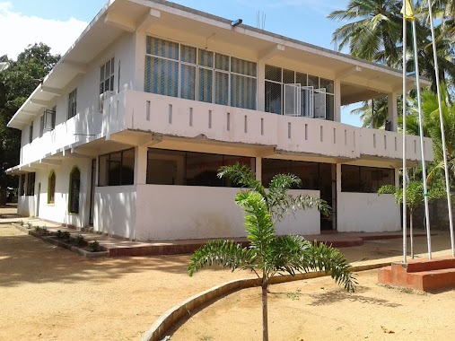
School nearby Galapitagala Vidyalaya
Sri Lanka
School nearby Galapitagala Vidyalaya
Galapitagala Vidyalaya
Anuradhapura, Sri Lanka
contacts phone
:
+94
Latitude:
8.0861571
, Longitude:
80.6664339
larger map & directions
read more
nearest School
4.226 km
Ganewalpola Muslim Maha Vidyala
Ganewalpola
School
read more
5.15 km
AL-HAMRA PRESCHOOL UTTIPPITIYA
Ganewelpola - Dachchahalmillewa Road
School
read more
5.729 km
Palugaswewa Maha Vidyalaya
Palugaswewa
School
read more
8.508 km
Pusdewulwewa Vidyalaya
Anuradhapura
School
read more
8.588 km
Cradle Pre-School & Day Care Center
Kekirawa-Ganewalpola Road, Kekirawa
School
read more
9.327 km
Kekirawa Muslim Maha Viddiyalaya
A9, Kekirawa
School
read more
9.332 km
Modal Primary School
modal primary school,kakirawe
School
read more
9.341 km
Vidura Institute - Kekirawa
Talawa Road, Kekirawa
School
read more
9.511 km
Super Kingsway International School
Kekirawa
School
read more
9.527 km
Bendiwewa Primary School
megodawewa, Anuradhapura
School
read more
9.926 km
A/ Kekirawa Primary School
Talawa Road, Kekirawa
School
read more
9.931 km
Samanala PreSchool
A9, Thibbatuwewa
School
read more
10.031 km
School Quarters
Talawa Road, Kekirawa
School
read more
10.077 km
Kids' Home Pre School
Thibbatuwewa
School
read more
12.159 km
Public School
Sri Lanka
School
read more
12.47 km
Thibbatuwewa Maha Vidyalaya
Sri Lanka
School
read more
12.51 km
A/Pllekagama Vidyalaya
Anuradhapura
School
read more
12.575 km
Nawakkulama Vidyalaya
Anuradhapura
School
read more
12.879 km
Ihala Puliyankulama Muslim Vidyalaya
Anuradhapura
School
read more
13.049 km
Digampathaha Junior School
Dambulla
School
read more
14.066 km
Al-Mina Pre School Horapola
Distrito de Anuradhapura
School
read more
14.22 km
Dharul Hudha Preschool
Udanidigama
School
read more
14.79 km
A / Sri Rewatha Maha Vidyalaya - Madatugama
A9, Madatugama
School
read more
15.961 km
Vijithpura Maha Vidyalaya
Thoniyagala - Kalawewa - Galewela Road
School
read more
19.032 km
Athungama Gemunu Maha Vidyalaya
Anuradhapura
School
read more
📑
all categories
Accounting
Administrative area level 1
Administrative area level 2
Airport
Amusement park
Aquarium
Art gallery
Atm
Bakery
Bank
Bar
Beauty salon
Bicycle store
Book store
Bowling alley
Bus station
Cafe
Campground
Car dealer
Car rental
Car repair
Car wash
Casino
Cemetery
Church
City hall
Clothing store
Colloquial area
Convenience store
Country
Courthouse
Dentist
Department store
Doctor
Electrician
Electronics store
Embassy
Finance
Fire station
Florist
Food
Funeral home
Furniture store
Gas station
General contractor
Grocery or supermarket
Gym
Hair care
Hardware store
Health
Hindu Temple
Home goods store
Hospital
Insurance agency
Intersection
Jewelry store
Laundry
Lawyer
Library
Light rail station
Liquor store
Local government office
Locality
Locksmith
Lodging
Meal delivery
Meal takeaway
Mosque
Movie rental
Movie theater
Moving company
Museum
Natural feature
Neighborhood
Night club
Painter
Park
Parking
Pet store
Pharmacy
Physiotherapist
Place of worship
Plumber
Point of interest
Police
Political
Post office
Premise
Real estate agency
Restaurant
Roofing contractor
Route
Rv park, camping
School
Shoe store
Shopping mall
Spa
Stadium
Storage
Store
Subpremise
Supermarket
Synagogue
Taxi stand
Train station
Transit station
Travel agency
University
Veterinary care
Zoo
administrative area level 3
sublocality level 1
sublocality level 2
↑