School nearby Pathadumbara Maha Vidyalaya
Sri Lanka
School nearby Pathadumbara Maha Vidyalaya
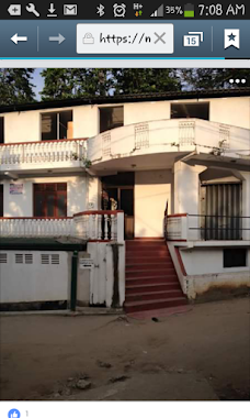
Pathadumbara Maha Vidyalaya
Menikhinna, Sri Lanka
contacts phone
:
+94
Latitude:
7.3198959
, Longitude:
80.6907552
larger map & directions
read more
nearest School
307 m
A.Rathnayaka Central College
Menikhinna
School
read more
532 m
Tiny Kids
B256, Jambugahapitiya
School
read more
985 m
Kids Cabin
04 Kukuloya Road, Menikhinna
School
read more
1.08 km
Hurikaduwa Balika Maha Vidyalaya
Sapugahamulawatte Road, Menikhinna
School
read more
1.117 km
Cp/wa/pathadumbara Maha Vidyalaya
Jambugahapitiya
School
read more
1.135 km
Hurikaduwa Balika Maha Vidyalaya
Menikhinna
School
read more
1.346 km
Tiny Kids Pre School
Menikhinna
School
read more
1.786 km
Udagama Maha Vidyalaya, Menikhinna
Lane 4, Kandy
School
read more
1.795 km
Al-Aqsa Muslim Viddiyalaya
Nugadeniya Road Pilawala, Amunugama - Walala Road, Jambugahapitiya
School
read more
1.82 km
Udagama Buddhist Maha Vidyalaya
Menikhinna
School
read more
1.836 km
Napana Junior School
Aloka Mawatha
School
read more
1.841 km
Hillcountry International School
Madawala
School
read more
1.974 km
Wavinna Primary School
Wavinna
School
read more
1.999 km
Samadi Pre - school
9th Lane, Kundasale
School
read more
2.038 km
Al Hudha International School
Madawala
School
read more
2.038 km
Pitiyegedara Primary School
Katugastota - Madawala - Bambarella Road
School
read more
2.081 km
Pilawala Navodya Maha Vidyalaya
Pilawala
School
read more
2.204 km
Madina National School
Madawala
School
read more
2.266 km
HELC ( Hillcountry Early Learning Centre)
Pitiyagedera - Wattegama - Iriyagastenne Road, Madawala
School
read more
2.411 km
Wattegama Vocational Training Center
12/C Katugastota - Madawala - Bambarella Road, Wattegama
School
read more
2.537 km
Henawala Maha Vidyalaya
Menikhinna- Kengalla Road
School
read more
2.692 km
الكلية العربية الرحيمية
Mosque Road, Madawala
School
read more
3.008 km
Mahawaththa Maha Vidyalaya
Mahawaththa
School
read more
3.083 km
Yatirawana Maha Vidyalaya
Wattegama
School
read more
3.116 km
Yatirawana Maha Vidyalaya Entrance
Wattegama
School
read more
📑
all categories
Accounting
Administrative area level 1
Administrative area level 2
Airport
Amusement park
Aquarium
Art gallery
Atm
Bakery
Bank
Bar
Beauty salon
Bicycle store
Book store
Bowling alley
Bus station
Cafe
Campground
Car dealer
Car rental
Car repair
Car wash
Casino
Cemetery
Church
City hall
Clothing store
Colloquial area
Convenience store
Country
Courthouse
Dentist
Department store
Doctor
Electrician
Electronics store
Embassy
Finance
Fire station
Florist
Food
Funeral home
Furniture store
Gas station
General contractor
Grocery or supermarket
Gym
Hair care
Hardware store
Health
Hindu Temple
Home goods store
Hospital
Insurance agency
Intersection
Jewelry store
Laundry
Lawyer
Library
Light rail station
Liquor store
Local government office
Locality
Locksmith
Lodging
Meal delivery
Meal takeaway
Mosque
Movie rental
Movie theater
Moving company
Museum
Natural feature
Neighborhood
Night club
Painter
Park
Parking
Pet store
Pharmacy
Physiotherapist
Place of worship
Plumber
Point of interest
Police
Political
Post office
Premise
Real estate agency
Restaurant
Roofing contractor
Route
Rv park, camping
School
Shoe store
Shopping mall
Spa
Stadium
Storage
Store
Subpremise
Supermarket
Synagogue
Taxi stand
Train station
Transit station
Travel agency
University
Veterinary care
Zoo
administrative area level 3
sublocality level 1
sublocality level 2
↑