Train station nearby Kompannavidiya Railway Station
Sri Lanka
Train station nearby Kompannavidiya Railway Station
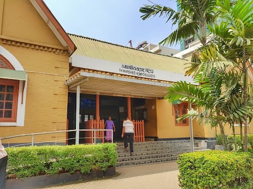
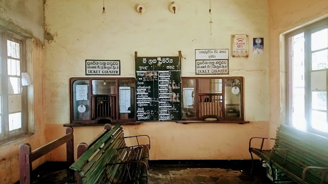
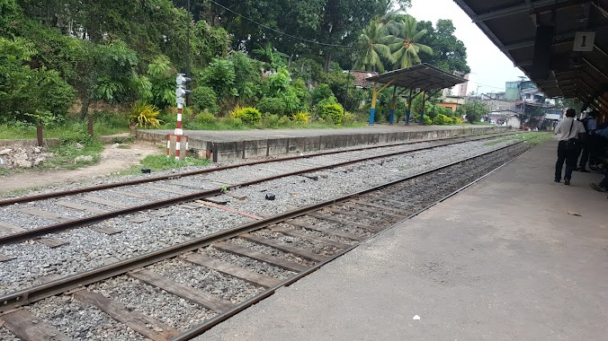
Kompannavidiya Railway Station
Station Passage, Colombo, Colombo, LK Sri Lanka
contacts phone
:
+94 112 422 624
website:
www.railway.gov.lk
Latitude:
6.9229572
, Longitude:
79.8495874
larger map & directions
read more
nearest Train station
1.074 km
Secretariat Halt
Colombo
Train station
read more
1.176 km
Fort Railway Station
Fort, Colombo
Train station
read more
1.31 km
Kollupitiya Railway Station
Colombo
Train station
read more
1.859 km
Maradana Railway Station
Jayantha Weerasekara Mawatha, Colombo
Train station
read more
3.209 km
Baseline Road Railway Station
Baseline Road, Colombo
Train station
read more
3.295 km
Bambalapitiya Railway Station
Colombo
Train station
read more
3.634 km
Dematagoda Railway Station
Kuppiyawatta East, Colombo
Train station
read more
3.999 km
Cotta Road
Colombo
Train station
read more
4.255 km
Narahenpita Railway Station
Colombo
Train station
read more
5.765 km
Kirillapona Railway Station
Kirulapone, Colombo
Train station
read more
6.531 km
Kelaniya Railway Station
Peliyagoda
Train station
read more
8.021 km
Wanawasala Railway Station
Wattala
Train station
read more
8.681 km
Pangiriwatta Railway Station
Pangiriwatta Road, Nugegoda
Train station
read more
9.12 km
Hunupitiya Railway Station
Train station
read more
9.397 km
Udahamulla Railway Station
Gangodavila South, Nugegoda
Train station
read more
10.252 km
Mount Lavinia Railway Station
Station Road, Dehiwala-Mount Lavinia
Train station
read more
11.9 km
Maharagama Railway Station
Maharagama
Train station
read more
12.868 km
Horape
Station Road, Ragama
Train station
read more
14.022 km
Angulana
Moratuwa
Train station
read more
14.301 km
Ragama Railway Station
Thewatta Road, Ragama
Train station
read more
14.548 km
Peralanda Railway Station
Ragama
Train station
read more
15.173 km
Kandana
Ja-Ela
Train station
read more
16.394 km
Malapalla Railway Station
Pannipitiya
Train station
read more
16.493 km
Walpola Railway Station
Ragama
Train station
read more
17.585 km
Batuwatta Railway Station
Train station
read more
📑
all categories
Accounting
Administrative area level 1
Administrative area level 2
Airport
Amusement park
Aquarium
Art gallery
Atm
Bakery
Bank
Bar
Beauty salon
Bicycle store
Book store
Bowling alley
Bus station
Cafe
Campground
Car dealer
Car rental
Car repair
Car wash
Casino
Cemetery
Church
City hall
Clothing store
Colloquial area
Convenience store
Country
Courthouse
Dentist
Department store
Doctor
Electrician
Electronics store
Embassy
Finance
Fire station
Florist
Food
Funeral home
Furniture store
Gas station
General contractor
Grocery or supermarket
Gym
Hair care
Hardware store
Health
Hindu Temple
Home goods store
Hospital
Insurance agency
Intersection
Jewelry store
Laundry
Lawyer
Library
Light rail station
Liquor store
Local government office
Locality
Locksmith
Lodging
Meal delivery
Meal takeaway
Mosque
Movie rental
Movie theater
Moving company
Museum
Natural feature
Neighborhood
Night club
Painter
Park
Parking
Pet store
Pharmacy
Physiotherapist
Place of worship
Plumber
Point of interest
Police
Political
Post office
Premise
Real estate agency
Restaurant
Roofing contractor
Route
Rv park, camping
School
Shoe store
Shopping mall
Spa
Stadium
Storage
Store
Subpremise
Supermarket
Synagogue
Taxi stand
Train station
Transit station
Travel agency
University
Veterinary care
Zoo
administrative area level 3
sublocality level 1
sublocality level 2
↑