Cafe nearby Gayan Tea Room
Sri Lanka
Cafe nearby Gayan Tea Room
Gayan Tea Room
Ekala-Kotadeniyawa Road, Kotugoda, Gampaha, LK Sri Lanka
contacts phone
:
+94
Latitude:
7.1247323
, Longitude:
79.9247378
larger map & directions
read more
nearest Cafe
490 m
Varuni Snak Bar
Ekala-Kotadeniyawa Road
Cafe
read more
2.4 km
P&S Bakers
Ja Ela-Ekala-Gampaha-Yakkala Highway, Ja-Ela
Cafe
read more
2.582 km
Mark Hotel
Ja Ela-Ekala-Gampaha-Yakkala Highway
Cafe
read more
2.722 km
Sanjana Cashew Products
Nedagamuwa
Cafe
read more
2.789 km
MS Foods
Katunayake
Cafe
read more
2.898 km
Janaka Hotel
Uggalboda Road, Paththanduwana
Cafe
read more
2.929 km
Sweet place
Isuru Uyana, Sri Jayawardenepura Kotte
Cafe
read more
2.994 km
Janitha Bakers Orex City
Ekala Orex City, No.3, B111, Ekala
Cafe
read more
3.054 km
Siyasra Luxury Banquets
173, Kotugoda Road, Seeduwa
Cafe
read more
3.054 km
www.cake.lk
Janitha Group, 173/1, Kotugoda Road, Seeduwa
Cafe
read more
3.736 km
Dilus Hotel
Ja-Ela
Cafe
read more
4.155 km
Shan's Cafe
Dharmaloka Mawatha, Ja-Ela
Cafe
read more
4.216 km
Singha Grocery
Bandarawaththa Road, Seeduwa
Cafe
read more
4.486 km
Nilame stores
Samagi Mawatha
Cafe
read more
5.309 km
Hotel Divya
-1, 3C A3, Ja-Ela
Cafe
read more
5.488 km
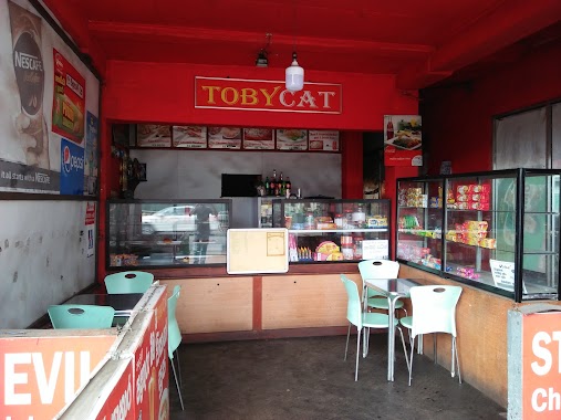
Tobycat
Puttalam - Colombo Road, Ja-Ela
Cafe
read more
5.495 km
Crispy Food
Christ King Road, Ja-Ela
Cafe
read more
5.538 km
Thakshila Food House
A33, Ja-Ela
Cafe
read more
5.838 km
POOMAA CAFE
81/A Negombo-Colombo Main Road, Ja-Ela
Cafe
read more
5.971 km
Crimson Bakery By Laugfs Super
Gampaha
Cafe
read more
6.007 km
Bread Papa
Ja-Ela
Cafe
read more
8.484 km
SEEDS - Juice Station
17 Marybiso Road, Gampaha
Cafe
read more
9.056 km
JUC Cafe Arpico
Ja Ela-Ekala-Gampaha-Yakkala Highway, Gampaha
Cafe
read more
13.163 km
Stollen
No 391/A Main Street, Negombo
Cafe
read more
15.937 km
H.M Juice Bar & Snack Corner
108 Porutota Road, Negombo
Cafe
read more
📑
all categories
Accounting
Administrative area level 1
Administrative area level 2
Airport
Amusement park
Aquarium
Art gallery
Atm
Bakery
Bank
Bar
Beauty salon
Bicycle store
Book store
Bowling alley
Bus station
Cafe
Campground
Car dealer
Car rental
Car repair
Car wash
Casino
Cemetery
Church
City hall
Clothing store
Colloquial area
Convenience store
Country
Courthouse
Dentist
Department store
Doctor
Electrician
Electronics store
Embassy
Finance
Fire station
Florist
Food
Funeral home
Furniture store
Gas station
General contractor
Grocery or supermarket
Gym
Hair care
Hardware store
Health
Hindu Temple
Home goods store
Hospital
Insurance agency
Intersection
Jewelry store
Laundry
Lawyer
Library
Light rail station
Liquor store
Local government office
Locality
Locksmith
Lodging
Meal delivery
Meal takeaway
Mosque
Movie rental
Movie theater
Moving company
Museum
Natural feature
Neighborhood
Night club
Painter
Park
Parking
Pet store
Pharmacy
Physiotherapist
Place of worship
Plumber
Point of interest
Police
Political
Post office
Premise
Real estate agency
Restaurant
Roofing contractor
Route
Rv park, camping
School
Shoe store
Shopping mall
Spa
Stadium
Storage
Store
Subpremise
Supermarket
Synagogue
Taxi stand
Train station
Transit station
Travel agency
University
Veterinary care
Zoo
administrative area level 3
sublocality level 1
sublocality level 2
↑