Pharmacy nearby Sesanda Pharmacy
Sri Lanka
Pharmacy nearby Sesanda Pharmacy
Sesanda Pharmacy
Kadawatha Sri Lanka
contacts phone
:
+94
Latitude:
7.025125
, Longitude:
79.9783739
read more
nearest Pharmacy
352 m
Shayama Pharmacy
A1, Kadawatha
Pharmacy
read more
2.061 km
Asiri Pharmacy
Pahala Imbulgoda East, Pahala Imbulgoda
Pharmacy
read more
2.532 km
New Soorigama Pharmacy
Sri Lanka
Pharmacy
read more
3.628 km
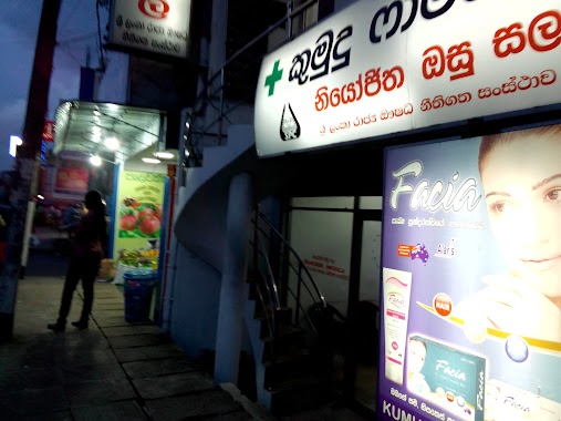
Kumudu Pharmacy
135/5, Kandy Road, Kadawatha
Pharmacy
read more
3.755 km
Sulalitha Pharmacy
27, Kandy Road, Kadawatha
Pharmacy
read more
3.755 km
Sulalitha Pharmacy
27, A1, Kadawatha
Pharmacy
read more
3.836 km
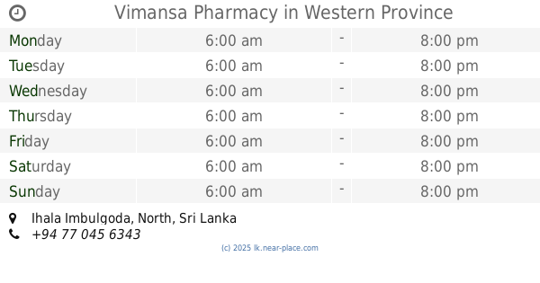
Vimansa Pharmacy
Ihala Imbulgoda
Pharmacy
read more
4.028 km
Isuru Pharmacy
No.175/1, Ragama Road, Kadawatha
Pharmacy
read more
4.339 km
Nawaloka Lab
Makola - Udupila Road, Mawaramandiya
Pharmacy
read more
4.565 km
Smarasinghe Pharmacy
B13, Neligama
Pharmacy
read more
4.799 km
Dove Pharmacy
B13
Pharmacy
read more
4.906 km
Seetha Pharmacy
Ganemulla North, Ganemulla
Pharmacy
read more
5.008 km
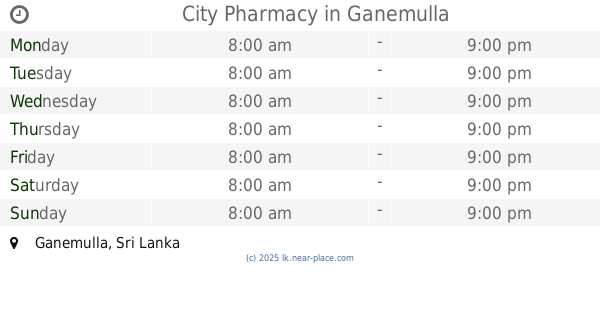
City Pharmacy
Ganemulla
Pharmacy
read more
5.017 km
Kema Pharmacy
Ganemulla North, Ganemulla
Pharmacy
read more
5.075 km
K. Pharma Pharmacy.
Makola - Udupila Road
Pharmacy
read more
5.298 km
Pharmacy
90/5,Naranwal New Kandy Road
Pharmacy
read more
5.711 km
Laugf Phamacy
Delgoda
Pharmacy
read more
5.717 km
Nawaloka Sampal Collecting Centre
109/3 New Kandy Road, Weliweriya
Pharmacy
read more
5.781 km
New Lanka Pharmacy
A1, Kadawatha
Pharmacy
read more
5.817 km
Pasyale Ayurveda Osu (PVT) LTD.
Gampaha
Pharmacy
read more
7.767 km
Sampath Pharmacy
Fonseka Villa, B13, Ragama
Pharmacy
read more
12.633 km
New Peoples Pharmacy
3 Biyagama Road, Peliyagoda
Pharmacy
read more
13.39 km
Senarathne Pharmacy
No:29, super market Gothatuwa newtown Sri lanka.
Pharmacy
read more
15.009 km
Carewell Pharmacy
Sri Lanka
Pharmacy
read more
15.684 km
Suwahasa Phamacy
Pannipitiya Rd, Battaramulla
Pharmacy
read more
📑
all categories
Accounting
Administrative area level 1
Administrative area level 2
Airport
Amusement park
Aquarium
Art gallery
Atm
Bakery
Bank
Bar
Beauty salon
Bicycle store
Book store
Bowling alley
Bus station
Cafe
Campground
Car dealer
Car rental
Car repair
Car wash
Casino
Cemetery
Church
City hall
Clothing store
Colloquial area
Convenience store
Country
Courthouse
Dentist
Department store
Doctor
Electrician
Electronics store
Embassy
Finance
Fire station
Florist
Food
Funeral home
Furniture store
Gas station
General contractor
Grocery or supermarket
Gym
Hair care
Hardware store
Health
Hindu Temple
Home goods store
Hospital
Insurance agency
Intersection
Jewelry store
Laundry
Lawyer
Library
Light rail station
Liquor store
Local government office
Locality
Locksmith
Lodging
Meal delivery
Meal takeaway
Mosque
Movie rental
Movie theater
Moving company
Museum
Natural feature
Neighborhood
Night club
Painter
Park
Parking
Pet store
Pharmacy
Physiotherapist
Place of worship
Plumber
Point of interest
Police
Political
Post office
Premise
Real estate agency
Restaurant
Roofing contractor
Route
Rv park, camping
School
Shoe store
Shopping mall
Spa
Stadium
Storage
Store
Subpremise
Supermarket
Synagogue
Taxi stand
Train station
Transit station
Travel agency
University
Veterinary care
Zoo
administrative area level 3
sublocality level 1
sublocality level 2
↑