Restaurant nearby Magalakshmi veg hotel
Sri Lanka
Restaurant nearby Magalakshmi veg hotel
Magalakshmi veg hotel
Jaffna, Sri Lanka
contacts phone
:
+94
Latitude:
9.6741704
, Longitude:
80.0271409
larger map & directions
read more
nearest Restaurant
28 m
Suvaiyutu Vegetarian Hotel
Jaffna
Restaurant
read more
90 m
Luxsmy veg hotel
Jaffna
Restaurant
read more
187 m
Royal Cream House
Kovil Road, Jaffna
Restaurant
read more
273 m
Nallur Bhavan Vegetarian Restaurant
250 Kovil Road, Jaffna
Restaurant
read more
284 m
Nathan Cafe நாதன் கபே
Kovil Road, Jaffna
Restaurant
read more
285 m
Mangos Indian Veg
359/3, Temple Road, Jaffna
Restaurant
read more
541 m
Hari Restaurant
Jaffna
Restaurant
read more
615 m
Soon Fat
Nallur-Oddumadam Road, Jaffna
Restaurant
read more
718 m
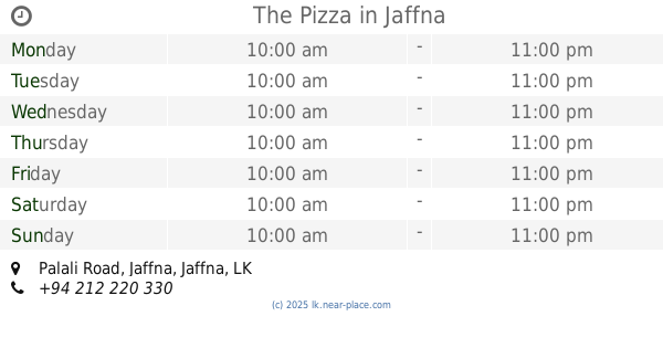
The Pizza
229, Palali Road, Jaffna
Restaurant
read more
832 m
Jaffna hotel
Moothathambi Lane, Jaffna
Restaurant
read more
866 m
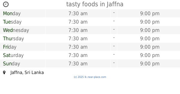
tasty foods
Jaffna
Restaurant
read more
884 m
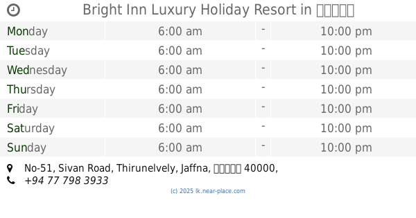
Bright Inn Luxury Holiday Resort
No-51, Sivan Road, Thirunelvely, Jaffna, யாழ்ப்பாணம்
Restaurant
read more
895 m
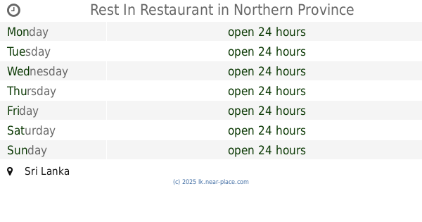
Rest In Restaurant
Sri Lanka
Restaurant
read more
906 m
VS Hotel
Jaffna
Restaurant
read more
933 m
Shakthi Hotel
Jaffna
Restaurant
read more
951 m
Yarl Rest
Palali Road, Jaffna
Restaurant
read more
990 m
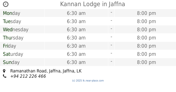
Kannan Lodge
Ramanathan Road, Jaffna
Restaurant
read more
1.222 km
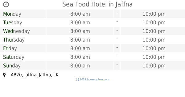
Sea Food Hotel
AB20, Jaffna
Restaurant
read more
1.275 km
Golden Star Restorent
Jaffna
Restaurant
read more
1.663 km
Jeevan
Jaffna
Restaurant
read more
1.808 km
நெய்தல் போசனசாலை (Neithal Hotel)
183 Aadiyapatham Road, Jaffna
Restaurant
read more
1.857 km
Vijaya Cool bar
bus stand, Jaffna
Restaurant
read more
1.87 km
Lingan Ice Cream
213 Stanley road, යාපනය
Restaurant
read more
1.953 km
Hotel Omex
Jaffna
Restaurant
read more
2.439 km
Chelva Restaurant
1229, AB16, Jaffna
Restaurant
read more
📑
all categories
Accounting
Administrative area level 1
Administrative area level 2
Airport
Amusement park
Aquarium
Art gallery
Atm
Bakery
Bank
Bar
Beauty salon
Bicycle store
Book store
Bowling alley
Bus station
Cafe
Campground
Car dealer
Car rental
Car repair
Car wash
Casino
Cemetery
Church
City hall
Clothing store
Colloquial area
Convenience store
Country
Courthouse
Dentist
Department store
Doctor
Electrician
Electronics store
Embassy
Finance
Fire station
Florist
Food
Funeral home
Furniture store
Gas station
General contractor
Grocery or supermarket
Gym
Hair care
Hardware store
Health
Hindu Temple
Home goods store
Hospital
Insurance agency
Intersection
Jewelry store
Laundry
Lawyer
Library
Light rail station
Liquor store
Local government office
Locality
Locksmith
Lodging
Meal delivery
Meal takeaway
Mosque
Movie rental
Movie theater
Moving company
Museum
Natural feature
Neighborhood
Night club
Painter
Park
Parking
Pet store
Pharmacy
Physiotherapist
Place of worship
Plumber
Point of interest
Police
Political
Post office
Premise
Real estate agency
Restaurant
Roofing contractor
Route
Rv park, camping
School
Shoe store
Shopping mall
Spa
Stadium
Storage
Store
Subpremise
Supermarket
Synagogue
Taxi stand
Train station
Transit station
Travel agency
University
Veterinary care
Zoo
administrative area level 3
sublocality level 1
sublocality level 2
↑