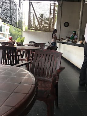
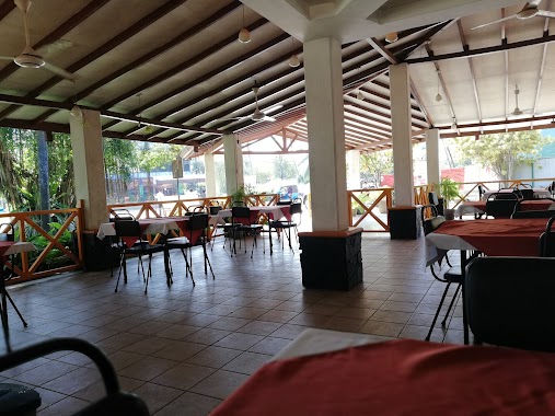
Restaurant nearby Niyas Nana Tea
Sri Lanka
Restaurant nearby Niyas Nana Tea
Niyas Nana Tea
Kahatowita, Sri Lanka
contacts phone
:
+94
Latitude:
7.0984865
, Longitude:
80.1139838
larger map & directions
read more
nearest Restaurant
1.43 km
Anas Hottel(Kt)
Sri Lanka
Restaurant
read more
2.245 km
The Longway Reception Hall
Udugaha Walpola, Ruggahawila, B445
Restaurant
read more
2.543 km
Ranabima Stores
B434
Restaurant
read more
2.739 km
Natasha roxxy Hotel
Gampaha
Restaurant
read more
3.027 km
Senani hotel
Wathupitiwala
Restaurant
read more
3.245 km
Ranjith Hotel & Grocery / රංජිත් හෝටලය
Veyangoda Road,, Urapola
Restaurant
read more
3.715 km
Sanushi Reception Hall
Walaliyadda Gamsabha Para
Restaurant
read more
4.005 km
Sampath Hotel
Hanwella - Kirindiwela - Urapola Road, Mivitigammana
Restaurant
read more
4.096 km
Ivory Palace
Aththanagalla-Galapitamada Road
Restaurant
read more
4.191 km
Restaurant-Nelligahamula
Gampaha
Restaurant
read more
4.614 km
Imara Chinese food
Nittambuwa
Restaurant
read more
4.665 km
Bangkok Choice
Sri Lanka
Restaurant
read more
4.946 km
Mountain Ray Restaurent
Nittambuwa
Restaurant
read more
5.077 km
Hot Edge Restaurant
Gampaha
Restaurant
read more
5.123 km
NOM pastry Shop & Dine In
Colombo - Kandy Road, Nittambuwa
Restaurant
read more
5.137 km
Pol Athu Bath Kade
A1
Restaurant
read more
5.151 km
141(වන්4ONE Family Restaurant
New sandagiri Trade Center, 651 Nittambuwa - Ruwanwella Road, Nittambuwa
Restaurant
read more
5.432 km
Hopper Shop
Gampaha
Restaurant
read more
5.549 km
Hela Bojun Hala හෙළ බොජුන් හල
Malwatta Jct., Nittambuwa
Restaurant
read more
5.55 km
Sena's Family Restaurant
Malwatta Junction, Nittambuwa
Restaurant
read more
5.551 km
Sena's Family Restaurant
Sri Lanka
Restaurant
read more
5.669 km
New Zumlaa Maniok Chips
Sri Lanka
Restaurant
read more
5.669 km
New Zumlaa Maniok Chips
Restaurant
read more
5.669 km
New Zumlaa Maniok Chips
281 Waarana Road, Kalagedihena
Restaurant
read more
5.701 km
Mother's Kitchen
111/A A1, Kalagedihena
Restaurant
read more
📑
all categories
Accounting
Administrative area level 1
Administrative area level 2
Airport
Amusement park
Aquarium
Art gallery
Atm
Bakery
Bank
Bar
Beauty salon
Bicycle store
Book store
Bowling alley
Bus station
Cafe
Campground
Car dealer
Car rental
Car repair
Car wash
Casino
Cemetery
Church
City hall
Clothing store
Colloquial area
Convenience store
Country
Courthouse
Dentist
Department store
Doctor
Electrician
Electronics store
Embassy
Finance
Fire station
Florist
Food
Funeral home
Furniture store
Gas station
General contractor
Grocery or supermarket
Gym
Hair care
Hardware store
Health
Hindu Temple
Home goods store
Hospital
Insurance agency
Intersection
Jewelry store
Laundry
Lawyer
Library
Light rail station
Liquor store
Local government office
Locality
Locksmith
Lodging
Meal delivery
Meal takeaway
Mosque
Movie rental
Movie theater
Moving company
Museum
Natural feature
Neighborhood
Night club
Painter
Park
Parking
Pet store
Pharmacy
Physiotherapist
Place of worship
Plumber
Point of interest
Police
Political
Post office
Premise
Real estate agency
Restaurant
Roofing contractor
Route
Rv park, camping
School
Shoe store
Shopping mall
Spa
Stadium
Storage
Store
Subpremise
Supermarket
Synagogue
Taxi stand
Train station
Transit station
Travel agency
University
Veterinary care
Zoo
administrative area level 3
sublocality level 1
sublocality level 2
↑